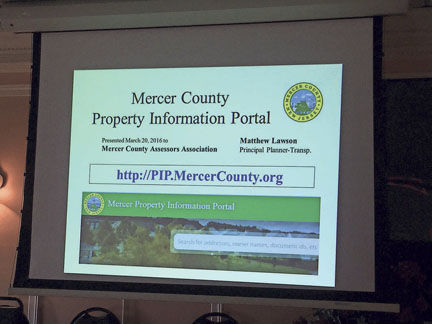
The New Jersey Open Public Records Act (OPRA) requires government agencies to share records when citizens request them. Mercer County has gone a step further to unveil an online Property Information Portal.
“People ask for copies of their property records more than just about anything else,” said Mercer County Executive Brian M. Hughes. “We wanted to make it easier for them and to reduce some of the costs of staff assistance, and photocopying, and damage to original documents.”
The Property Information Portal also brings access to records into the online search environment, which is more and more based on maps. The portal has a map search for records that are tightly tied to tax parcels, but also a text search function for documents that cannot be located on a map.
“Over the last decade,” Mr. Hughes said, “my administration and the county clerk, Paula Sollami-Covello, have made big investments in computerizing our official records. This is the next step, which is to make them available to the public all in one place.”
In New Jersey, every property transfer is made official only when it is recorded with the county clerk. Back in 1832, the Mercer county clerk recorded deeds by transcribing them, noting in an index what book and page they were written on. For the last 45 years, deeds have been photocopied and indexed in a computer database. In 2006, Ms. Sollami-Covello started storing digitally scanned copies of deeds and making them retrievable from the computerized index record. In recent years, her staff’s effort has been on back-scanning historical records, which now go back to 1978.
“I had created a computerized retrieval tool that professional title searchers use every day in my office,” Ms. Sollami-Covello said. “But I also wanted a tool that searchers and citizens could use to find a property on a map and get access to deeds that way.”
About four years ago, staff in the County Planning Division, which manages the county’s geographic information system (GIS), heard about Ms. Sollami-Covello’s interest. They also knew that the county tax administrator, Martin Guhl, wanted the same thing. Rather than creating three separate systems, Mr. Hughes asked all parties to work together and, with the Office of Records Management in the county’s Office of Information Technology, to build a single tool. The Planning Division took the lead.
“It’s really pretty complicated,” principal planner Matthew Lawson explained. “We have huge amounts of data in four separate systems with nearly 2 million records. The clerk’s is one. But the county tax administrator has his own system that interacts with the clerk’s indexed deeds and with municipal tax assessors. Then there is the county administration’s Records Information Management System, where scanned copies of tax appeals are kept, along with site plan and subdivision applications to the Planning Board and a lot of other document types. And we are trying to tie those together with the county’s enterprise GIS, which stores all kinds of spatial information, including parcel lines from scanned municipal tax maps, FEMA flood zones, building outlines, wetlands and steep slopes, and storm drains, and tree cover, and more.”
The County contracted with a GIS consulting firm, Civil Solutions of Hammonton, to design and build the system. “It’s modern, it’s sleek, and I hope it is user-friendly and intuitive,” said Mr. Lawson. “Civil Solutions understands this business and they have been really responsive.”
Mr. Lawson cautioned that the complexity of the system and the nature of the information that feeds it can make it frustrating to work with. “You can know something is there. It’s gotta be there. But your search comes up dry,” Mr. Lawson said. “The difference might be in how a name was typed when a record was indexed. Searching for DeLeon is going to come up with different results than searching for De Leon. That space makes a difference.
“And on the map side,” Mr. Lawson said, “we have snapshots of data that come in on different cycles and things can get out of step.” A parcel subdivision, for example, can change street addresses and tax block and lot numbers, which are key references to map data. It may take several years before every element of the system comes into alignment.
“And I get a headache when I think about history,” Mr. Lawson said. “Our first GIS parcel layer was created in 2004 and whole towns have changed their parcel reference systems since then.” One day, Mr. Lawson hopes, tax parcel maps from past decades can be stitched together for online viewing, like the US Geological Survey has done with historic topographic maps. But there is more work to be done with the current tool before that happens.
“The Property Information Portal adds to what Mercer County gives back its citizens,” Mr. Hughes said. “It lets our staff keep working with the systems they are familiar with, so we saved on those training and development costs. The cost of creating the system was mostly paid with fees the clerk charges for recording documents, as well as fees in every office for staff time performing searches and copying documents. With the Property Information Portal, we have eliminated the search and copy fees and made the information available, free to the public, in a self-service system.”
The site is up and open to the public at http://PIP.MercerCounty.org. Mr. Lawson urges visitors to create an account and to browse the help files before submitting feedback or asking for assistance.

